
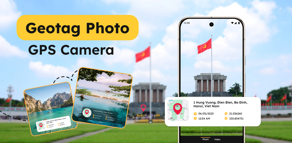
Geotag Photo: Camera Location 📍📸
GPS Camera Map is the ultimate app for families, travelers, and outdoor enthusiasts who want to document their experiences with real-time location details. Whether you’re capturing your child’s first adventure, documenting family trips, or ensuring safety with geotagged photos, this app is your perfect companion.
With GPS Camera Map Location, you can automatically embed essential details like latitude & longitude, street address, date, time, weather conditions, altitude, and more on every photo. Say goodbye to guessing where or when a picture was taken—let your images tell the full story!
Key Features 🌍✨
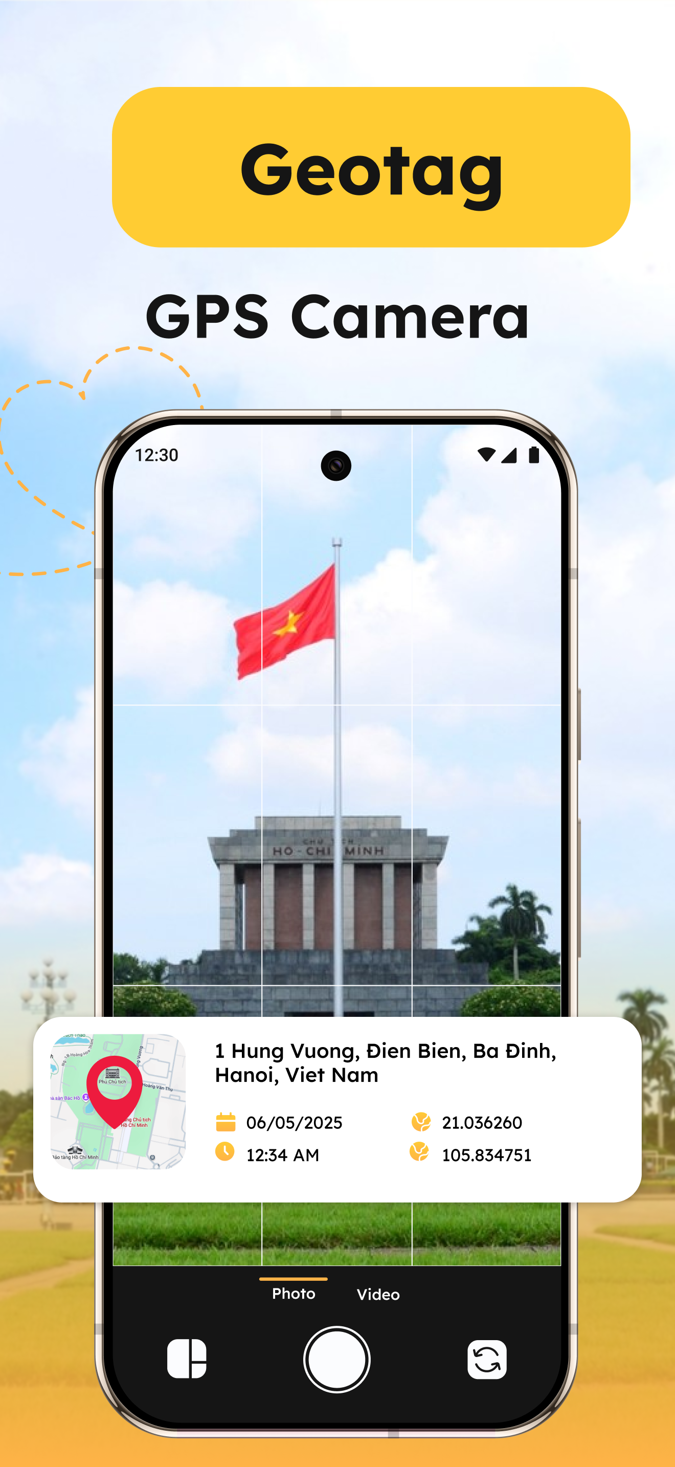
📌 GPS Location Stamp
Every photo taken using the app includes an automatic GPS location stamp, adding real-time latitude and longitude coordinates to your images. This feature ensures precise location tracking, making it perfect for family trips, school outings, and adventure documentation.
🏡 Address Location overlay
Capture moments with exact street addresses displayed directly on the photo. Whether you’re taking pictures at a park, playground, school, or vacation destination, the address overlay helps keep memories accurate. It’s especially useful for parents tracking their kids’ locations during trips.
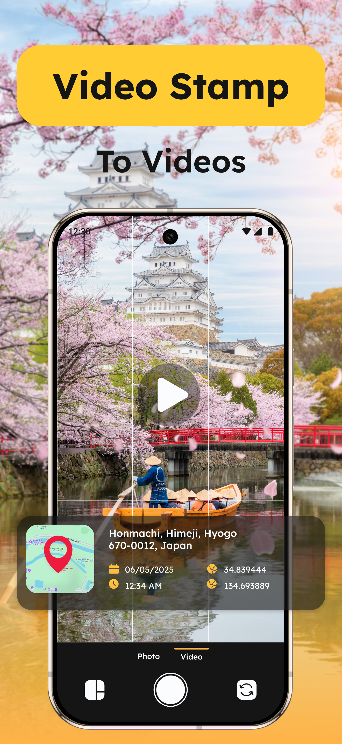
🕒 Date & Time Stamp
Want to record the exact moment of a special event? The date and time stamp feature ensures that every photo you take is time-marked, making it easy to track milestones, birthdays, school events, and family vacations.
🧭 Altitude & Compass Data
For travelers and outdoor enthusiasts, the altitude and compass data feature displays elevation and direction, making it perfect for hiking, camping, and adventure photography. Capture stunning mountain-top views while recording precise geographic details.
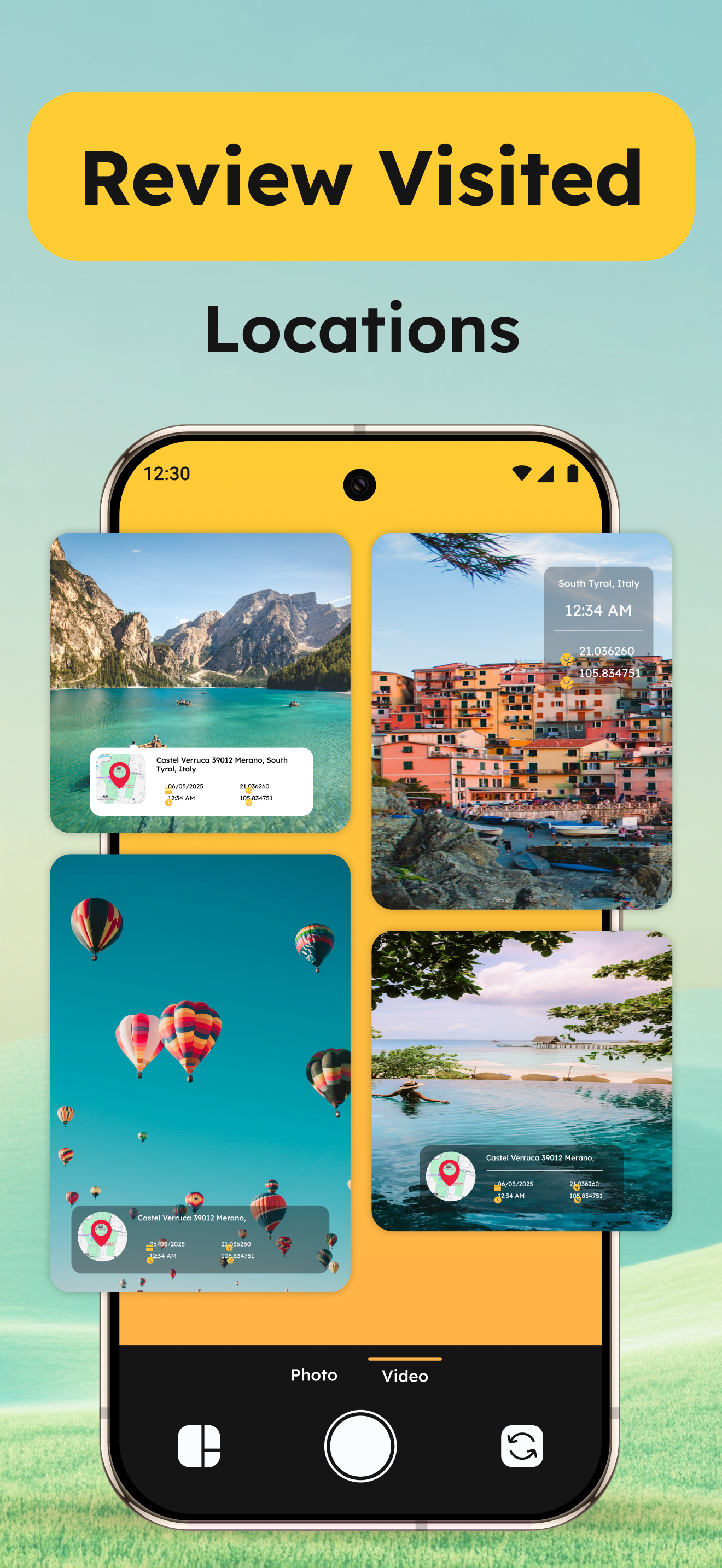
🗺️ Map View Integration
Want a visual representation of where your photos were taken? The app includes a live map view, allowing users to see exactly where each photo was captured. This feature is great for family road trips, nature walks, and location-based storytelling.
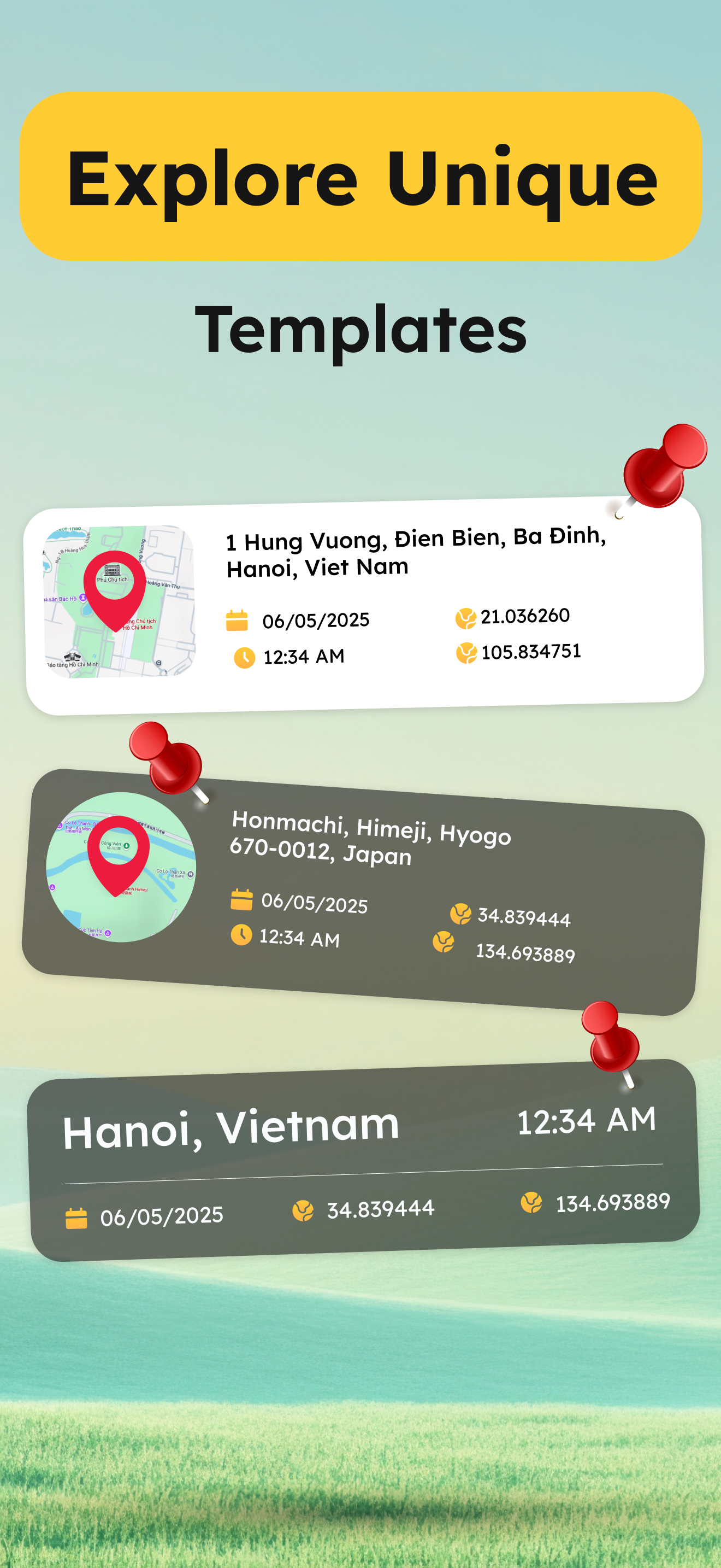
📍 Multiple Coordinate Formats
Choose between different GPS coordinate formats, including Decimal, DMS (Degrees, Minutes, Seconds), and UTM (Universal Transverse Mercator). This ensures that professionals, researchers, and adventurers can record geotag data in their preferred format.
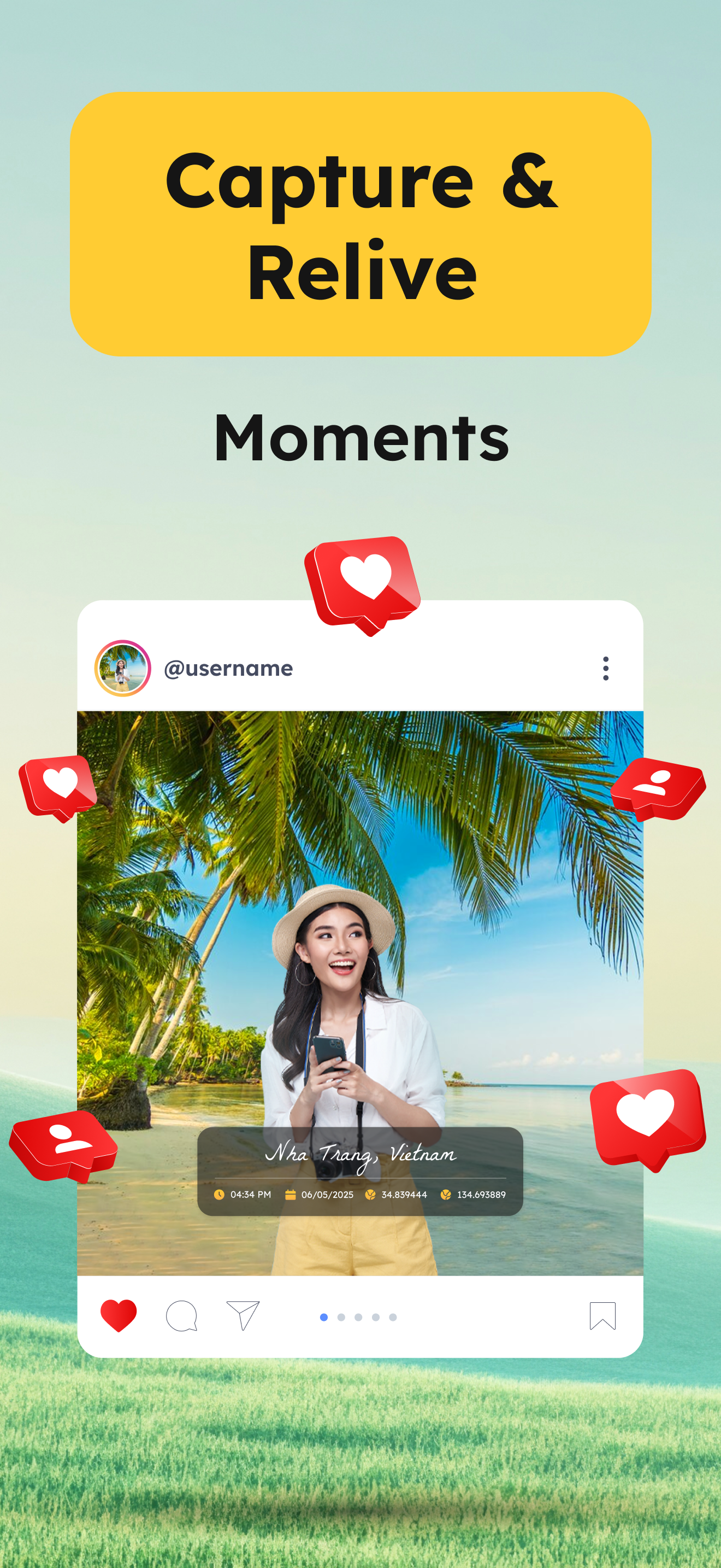
🔗 Easy Sharing Options
Once your photos are stamped and geotagged, share them instantly via social media, messaging apps, email, or cloud storage. Share memories with family or use them for work documentation with one tap!
Why Choose GPS navigation? 🏆
✔ Family-Friendly & Easy to Use – Perfect for parents tracking kids’ activities and creating lasting memories.
✔ Essential for Travelers & Outdoor Enthusiasts – Never forget where your adventures happened.
✔ Ideal for Professionals – Useful for real estate agents, field workers, event planners, and researchers who need geotagged photos.
✔ Offline Support – No need for constant internet access
✔ High-Quality Photos with Smart Overlays – Your photos remain clear, professional, and informative.
Who Can Benefit from This App? 🎯
Families & Parents – Keep track of children’s school trips, park visits, and daily activities with location-based photos.
Travelers & Adventurers – Capture and save the exact places you visit with location-stamped images.
How to Use GPS Camera Map – 3D World View? 📲
– Open the app and allow location permissions.
– Capture a photo – The app automatically stamps GPS details, date, time, and address.
– Customize the overlay with altitude or watermark.
– View your images on a map for a visual representation of locations.
– Share instantly via social media, email, or cloud storage.
Don’t miss a single important moment! With GPS Camera – 3D Street View, every photo tells a complete story with precise details.
📥 Download and start capturing, tracking, and sharing your family’s special moments today!